“If you try and fail, congratulations. Many won’t even try.“
September 23, 2021
Hike from Jarrard Gap to Hogpen Gap
AT miles: 11.9
Ascent: 3330’
Descent: 2914’
Weather: windy and sunny with temps in the high 60’s
Sightings: lots of day hikers
High points: the views from Blood Mountain
Today was sunny! I was so happy not to have to put the rain cover on my backpack!
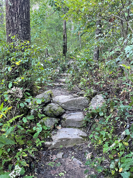
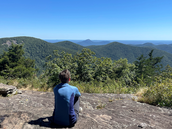
We began today by climbing Blood Mountain (4457’), the tallest mountain on the AT in Georgia. For the first bit the trail was easy, with lovely stone steps in the steep parts.
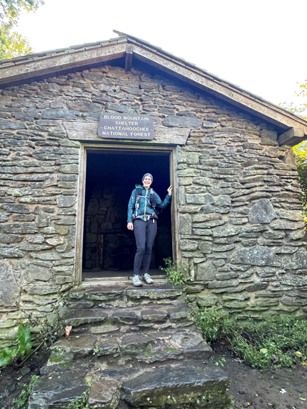
The trail was definitely a climb, but it was easier than its fierce reputation would suggest. Close to the top I passed Blood Mountain Shelter, a solid stone hut built in 1937 by the CCC. This shelter is as old as the Appalachian Trail, which was also formed in 1937!
The views from the top of Blood Mountain were amazing!
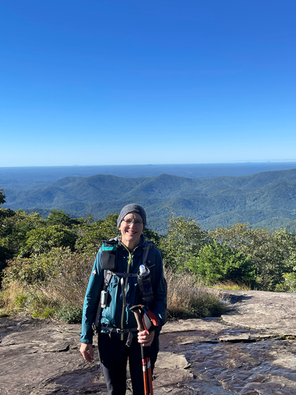
Even though Blood Mountain was beautiful and serene today, its history is not so peaceful. The mountain got its strange name from the horrible war that happened between the Creek and the Cherokee Indians in the 1500’s. Apparently the fighting was so intense that the mountain ran red with blood. The final battle in this war took place at the nearby creek that is now appropriately called Slaughter Creek.
The descent down Blood Mountain was steep. Because of my fall in Vermont, I am quite paranoid about slipping on rocks, so I did this descent extremely carefully.
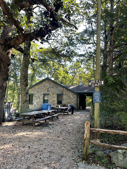
At the bottom of the mountain is Neel Gap, which is notorious on the AT for several reasons. First, at Neel Gap the trail passes through a building, the one and only time it does so in 2193 miles! Secondly, 30% of northbound thruhikers end their hike at (or before) Neel Gap and the tradition is that these trail dropouts throw their hiking boots over the “tree of shame,” located right in front of the store at Neel Gap. In this picture you can see the AT blaze on the building, and you can sort of see some hiking boots hanging off the tree.
I then hiked up Levelland Mountain (3833’). On the descent from this mountain the trail passed through acres of beautiful though slightly shaded wildflower meadows.
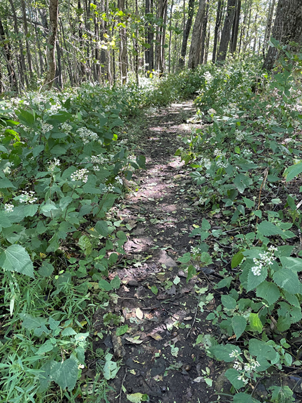
Goldenrods and pearly everlasting were the most common flower, but there were numerous others.
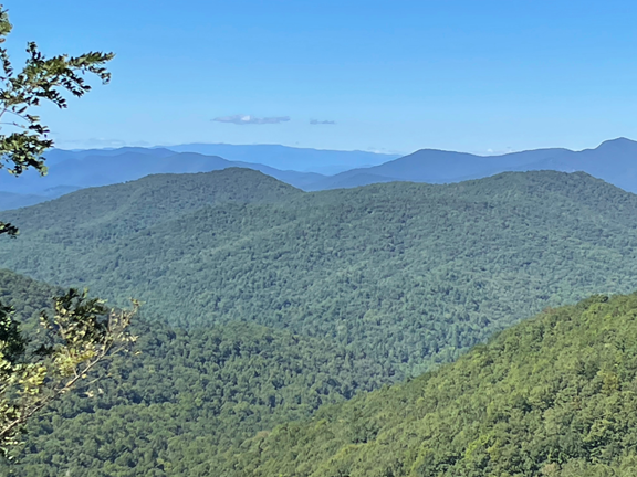
I had lunch at the top of Wolf Laurel Top (3763’), where there was a lovely view.
Only a few minutes later I came to the top of Cowrock Mountain (3809’). There was a HUGE slab of rock and a stellar view. I stopped and had my second lunch and napped for a bit on the warm rock.
After this I had a quick descent to Tesnatee Gap and had a super quick but challenging hike up and over Wildcat Mountain (3637’), arriving out of breath but happy at Hogpen Gap, my final destination for the day.
Hogpen Gap has gorgeous views of the mountains of North Georgia, including Brasstown Bald, the tallest mountain in Georgia!
The hike today was fun and challenging, and the views were outstanding. I am looking forward to tomorrow’s hike!
Today is a great day for a long walk in the woods!