Often when you think you’re at the end of something, you’re at the beginning of something else.
~Fred Rogers
October 3, 2021
Hike from Laurel Creek (VA Rt 615) to US Rt 52 (Bland, VA)
AT miles: 6.9
Ascent: 1178’
Descent: 658’
Weather: partly cloudy with temps in the high 60’s
High points: lots of spectacular mushrooms
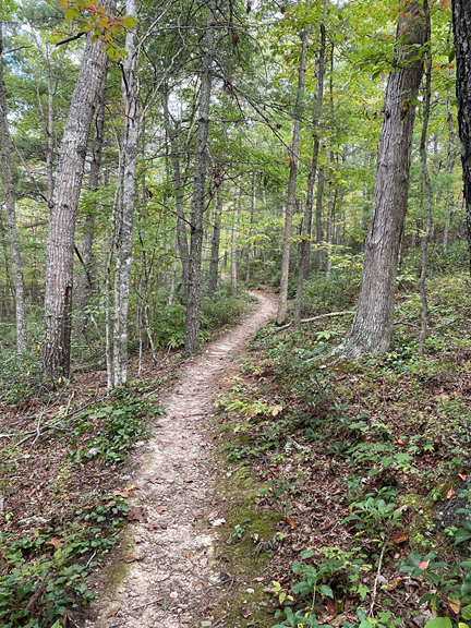
Today we climbed up to a ridge and hiked along the high path for miles. In this section the Appalachian Trail was smooth and fairly flat, which made for easy and fast walking.
Right now southwestern Virginia is experiencing a severe drought. Most of the water sources that we have walked by, including those at shelters, are dry. Most of the stream beds have no water at all in them. In wetter times this random jumble of rocks would be stepping stones through a creek that intersects the trail, but obviously the area is as dry as a bone.
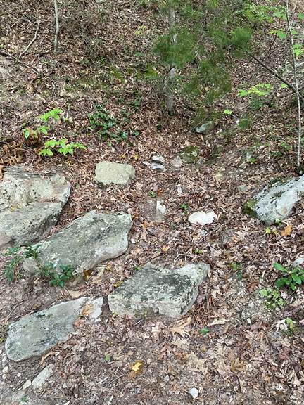
I am thankful that we are slack packing so we are able to refill our water each night. Currently finding water sources in this area is a challenge.
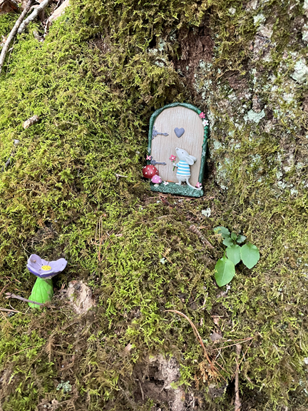
Fairy houses on trails are all the rage right now. An artist in Maryland started the trend when she built fairy houses out of natural materials (pebbles, sticks, acorns, etc.) along a path, and they have become ubiquitous in the woods. This one is not made of natural materials, but I found this particular set up quite charming.
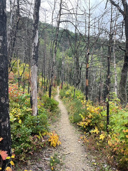
We came across an area that must have had a bad fire a few years ago — the trees were charred and bare, but the new bushes and young trees are already springing up to fill in the gaps left by the burned remains.
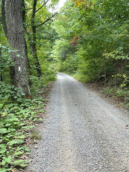
About a mile from the end, the trail joined a dirt road, which we followed down to Route 52.
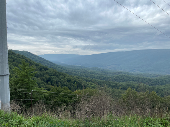
We had one or two views from the trail today but the best view of the day was actually through the clearing of the powerlines as we walked on the dirt road.
We trotted down the dirt road, surprised by all the trash. Passing by a few derelict but lived-in houses, we thought how odd it must be for the people who live there — they live in poverty yet literally thousands of hikers who have the financial means to take a walking holiday pass by their door every year.
We reached our car and headed home. At this point I have already hiked the sections of the AT that are near Williamsburg , so the drive home took around 5 hours.
Fall has arrived, and I am back to teaching. I am hoping to get away for one more weekend of AT hiking this fall before the weather gets too chilly, but due to the impending arrival of winter the 2021 hiking season is nearly over.
In any event, I have hiked over 800 miles on the AT this year, and I am content with that!
Today is a great day for a long walk in the woods!
YAYYAYAAYAYAAY!!! I’m reading Becoming Odyssa and thinking of you!!! See you soon!
Ashley
I am really enjoying resuming “normal” life! See you soon!
What an accomplishment! I’ve enjoyed following your adventures!