I never saw a Purple Cow,
I never hope to see one,
But I can tell you, anyhow,
I’d rather see than be one!
~Gelett Burgess
(The purple cow is the mascot of Williams College near where I was hiking today)
August 4, 2022
AT miles: 14.6
Ascent: 3479’
Descent: 3125’
Weather: low 90’s — hot and sunny, with a bang-up thunderstorm in the evening
Sightings: chipmunks, tons of tiny toads and a garter snake
High points: Summiting Mt. Greylock! (and surprise free pizza!)
I spent three hours this morning relocating both my car and myself. I drove from Manchester, VT, south to Great Barrington, MA, where I left my car, and then shuttled back to North Adams. When I was a kid my family frequently spent time in the Berkshires, so seeing the area brought back fond memories of weekends at Tanglewood.
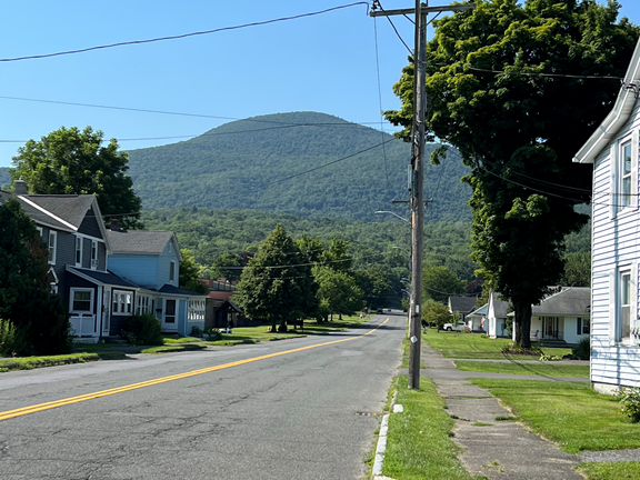
Heading south from North Adams, the AT wandered through the town for quite a while.
Then the trail did a steep ascent up Mt. Williams (2951’). It was really hot, and I was drenched by the time I reached Prospect Rock, a great viewpoint.
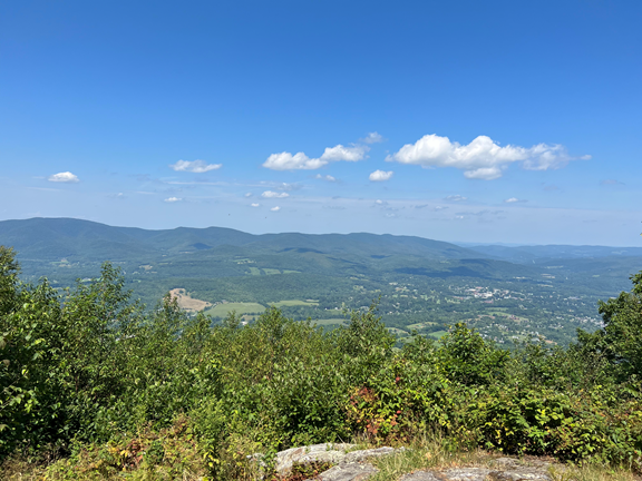
I appreciated the view from Prospect Rock firstly because it was the first great view I’ve had in several days, and secondly because Mt. Williams itself had no view at all.
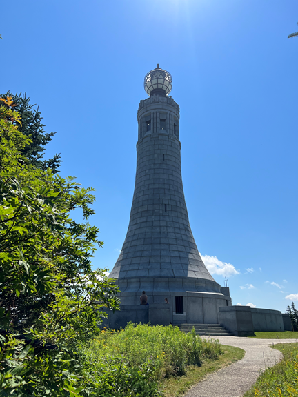
The trail continued upward to Mount Greylock (3462’), the highest peak in Massachusetts. There is a stunning War Memorial there. Fun AT fact — if you are going southbound on the AT, you will have to hike hundreds of miles and make your way all the way to central Virginia before you climb a mountain higher than Mt. Greylock!
Mount Greylock had three other features that I appreciated. First of all, there is a restaurant at the top so I bought a nice cold drink. Secondly, they provide free water to hikers. And thirdly, the views are really fantastic!
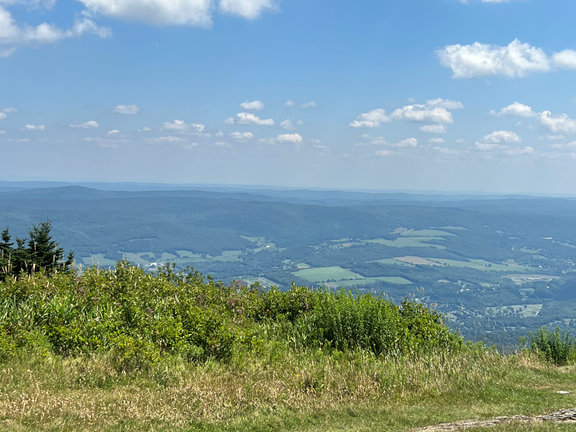
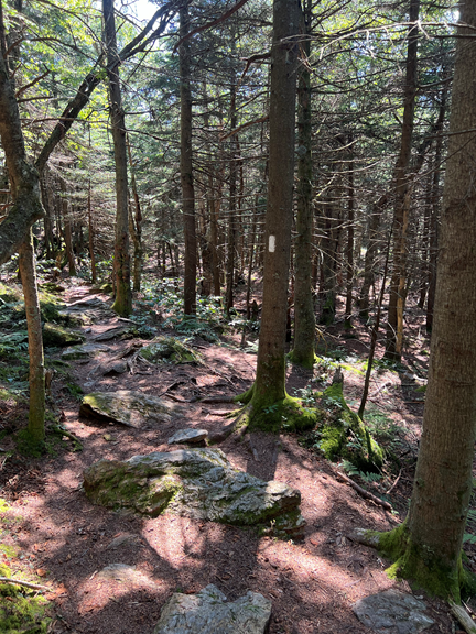
Mt. Greylock is high enough that near the summit it has the only boreal forest in Massachusetts. What that means is that the top was full of pine trees and moss.
The descent from Mount Greylock into Cheshire was super gradual, lasting nearly 8 miles. I went downhill almost exclusively for four hours! The weather was still horribly hot, so I was happy to have gravity helping me move along.
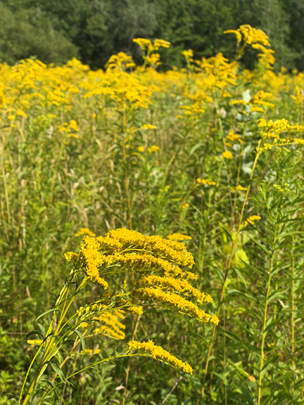
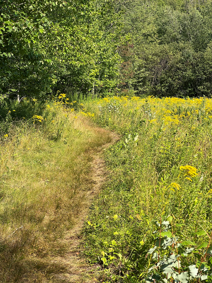
Near the end the trail went to several meadows that were just fields of goldenrod.
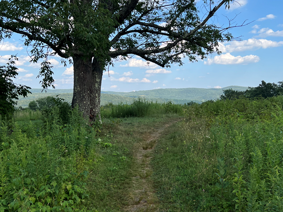
An old oak tree stood guard over the trail at one point, providing a stunning view of some mountains. I’m not sure whether they were part of the Green Mountains, the Taconic range, or the Berkshire Mountains, since all of those ranges start or end in this area.
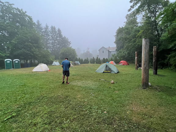
Around 6 p.m. I finally made it to Cheshire. I am staying at the Father Tom campground, named for a Catholic priest who used to put up hikers in the church basement in town until the fire department declared the practice unsafe. The town banded together and organized a hiker camping area, an empty lot with a picnic table and a bear box and a charging station and the cleanest port-a-potties you’ll ever find anywhere. And this evening someone from town came along and provided free pizza and subs for all the hikers!
I am thankful I arrived when I did, because just after I finished eating a violent thunderstorm rolled in. It is pouring and booming, but I am safe and dry in my tent.
Today is a great day for a long walk in the woods!
Glad you were able to settle into your tent before the rains hit!!
Free pizza and subs — another sign of extremely kind people in this
troubled world.