The best view comes after the hardest climb
August 9, 2022
AT miles: 13.1
Ascent: 1979’
Descent: 3039’
Weather: still super-hot, sunny, and hazy (high 80’s)
High points: the amazing ridge line walk southbound along Mt. Race
Despite the rain having stopped shortly after midnight, I woke up to a drenched world. Since today is my last day on trail, my wet stuff doesn’t matter, but I’m concerned about how slippery the wet rocks may be.
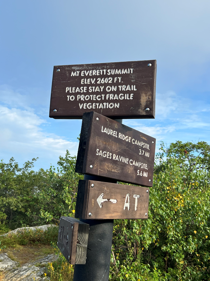
After only 1.2 miles of hiking, I summited Mt Everett, the tallest peak in the southern Taconic Mountains. The ascent was easier than I expected — apparently I did the hard part yesterday afternoon! However, I was right to be worried about the wet, slippery rocks. I had to be super vigilant and go extra slowly because the rocks in some places were as slippery as ice.
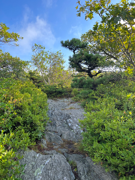
There were no views from the top of Mount Everett, but the feeling of space and peace and eternity was almost overwhelming. Jack pines and bayberry bushes gave the area a wonderful scent!
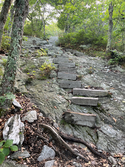
The trail was rocky, and the rocks were slippery, so the descent was quite challenging. The trail maintainers in the area seem to share my opinion that this is a difficult section of trail — they had mounted steps into the rocks in some locations.
The climb up Mount Race was more of a puzzle than a rock scramble. Occasionally there were seemingly insurmountable rock walls, and I had to figure out what combination of toeholds, tree roots, crevices, and rock handholds I could use to pull myself up.
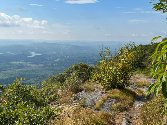
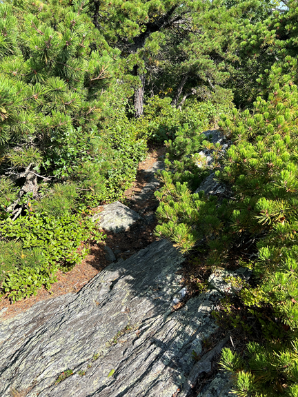
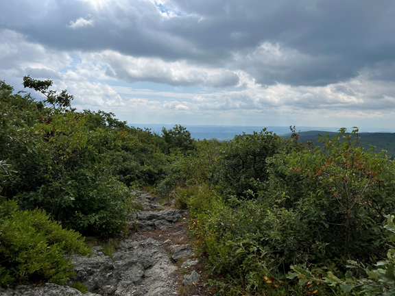
The views from the top of Mount Race made my extraordinary efforts to climb it worthwhile. For over a half a mile I walked along the Mount Race Ledges, which had stunning views. Apparently on a clear day you can even see as far as Mt. Greylock!
Like Mount Everett, the summit was full of beautiful twisted jack pines that resembled ancient gnarly bonsai!
The descent from Mount Race was fairly straightforward. I have not gotten water since yesterday’s trail magic in Sheffield, so I was happy to find a clear babbling brook. Because of the drought so many creek beds have been dry!
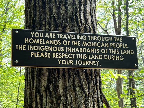
The trail meandered along the sides of several hills. I bumped into this sign, a good reminder that this land has not always just been home to the Appalachian Trail.
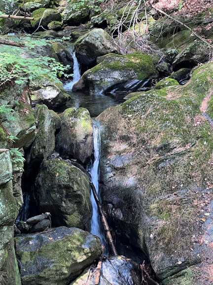
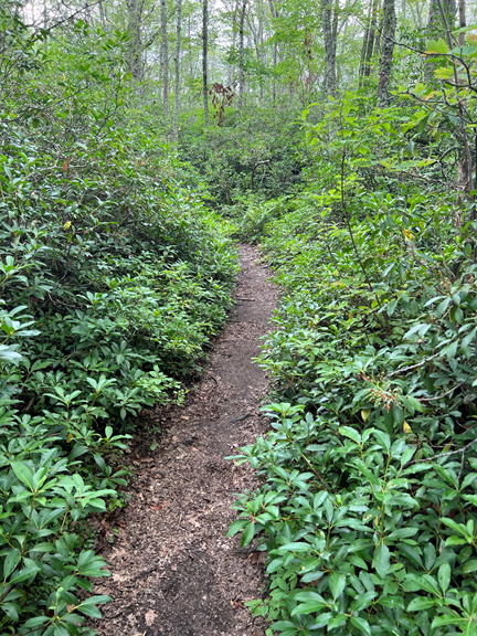
After about a mile and a half I entered Sage’s Ravine, a magical place full of moss, ferns, waterfalls, rocks, and mystery. The river had worn away deeply into the rock, so at times the river below the rocky banks was significantly wider than the banks themselves! This is truly a special place.
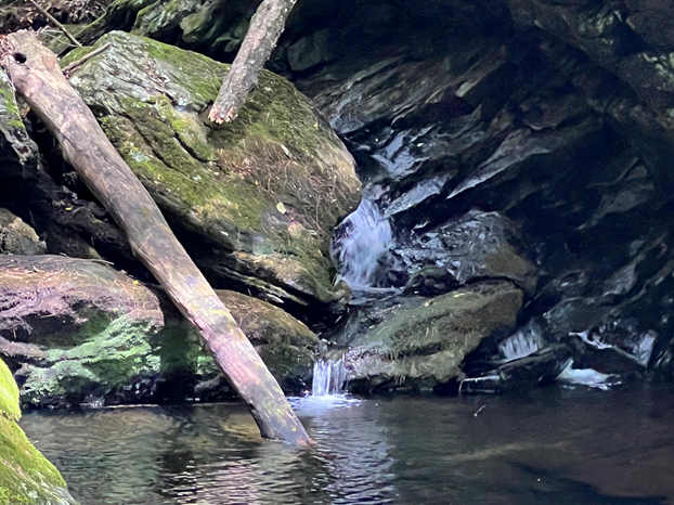
After about a mile and a half I entered Sage’s Ravine, a magical place full of moss, ferns, waterfalls, rocks, and mystery. The river had worn away deeply into the rock, so at times the river below the rocky banks was significantly wider than the banks themselves! This is truly a special place.
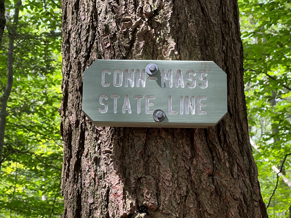
Emerging from Sage‘s Ravine, I came to this welcome sign confirming that I had successfully section-hiked all of the AT in Massachusetts.
I thought that I was home free. I only had 6 miles to go, and how bad can 6 miles be? Answer — extremely bad. The climb up Bear Mountain (2316’), the tallest mountain in Connecticut, was extraordinarily challenging. My guidebook describes the north side of this mountain as “steep and rocky”. Most people climb this mountain from the south, so they would be going down these treacherous rock faces. However, I was going up them. I had to use every bit of arm strength, leg strength, and balance to grab onto anything I could use to pull myself up. Some of the more polite words I was said to myself in this stretch were “You’ve got to be kidding…”
But even difficult times come to an end, and I eventually emerged victorious at the summit.
The views were pretty mediocre, but I could definitely see the rain clouds gathering.
After a few minutes of skittering down rocks, the trail once again became gentle. Sometimes the AT can be so extremely difficult, and at other times it can literally be a walk in the woods.
After dripping sweat all day, I was delighted to arrive at my car. Salisbury is an adorable town, but, like many expensive towns in the area, it has no remotely affordable overnight accommodations. I drove 30 minutes back to Great Barrington to grab dinner and a night at a hotel.
When I am not wondering what questionable life decisions landed me section-hiking Massachusetts and southern Vermont in the middle of both a nasty heat wave and an extreme drought, I’m filled with gratitude for my awesome section hike — 151.1 miles in 10 days, days of immense beauty and great challenge and a lot of sweat!
Today is a great day for a long walk in the woods!