Sometimes the fear won’t go away, so you’ll just have to do it afraid
August 30, 2022
Ascent: 741’
Descent: 671’
Weather: hot, hazy, and humid (mid-80’s)
Sightings: blue-tailed skinks, deer, chipmunks, and a woodpecker
High points: enjoying the views from Prospect Rock and completing the entire New Jersey section of the AT!
Today is the day that I have been dreading since I decided to section hike New Jersey. The Appalachian Trail in New Jersey isn’t particularly challenging, but the nearest AT road crossing north of the NJ/NY border is about 5 miles into New York. Those 5 miles are considered extremely challenging (despite the trivial altitude change!s). Some hikers consider these miles to be the hardest hiking from Springer Mountain in Georgia to this point in the trail.
Many hikers say that these 5 miles are slightly easier to tackle southbound, so I did today’s hike SOBO from Rt 17A to Warwick Turnpike and not the normal northbound way.
Since rock hopping is easier when you are carrying a daypack instead of 25 pounds, I arranged to slackpack today.
Additionally, the rocks today were bone-dry, which definitely makes clambering over rocks much easier. (I didn’t arrange that, but I am very thankful for it!)
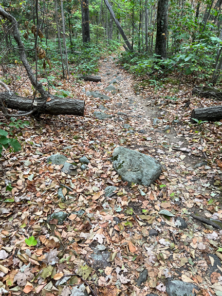
The first few miles of the hike today we’re completely normal.
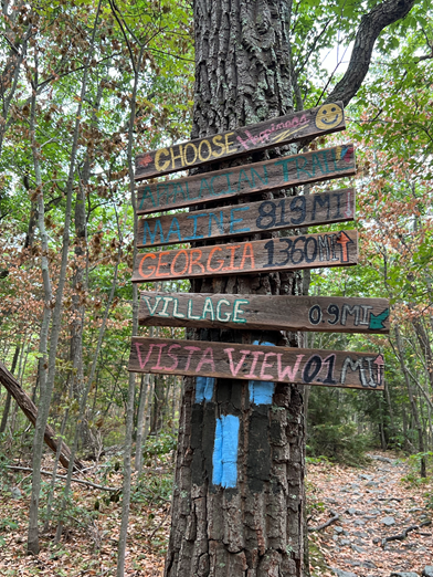
I bumped into a wonderful sign, with helpful arrows pointing to Georgia and Maine and Lakeside and a few other random locations.
Then the rocks began.
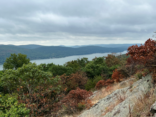
I had a fantastic view of Greenwood Lake to the east.
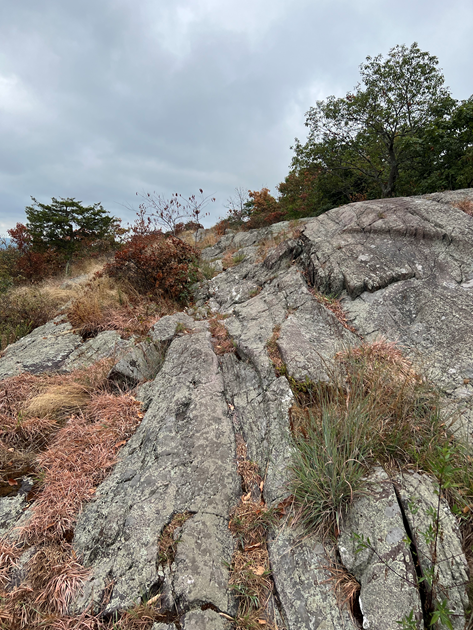
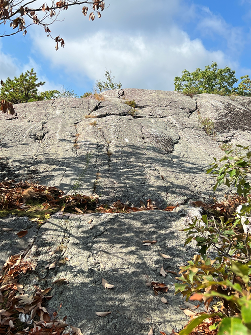
And then the rocks begin to get a lot more serious. This picture does not remotely do this particular rock justice. This rock face was steep enough that I had to climb up it on all fours, struggling for handholds and toeholds.
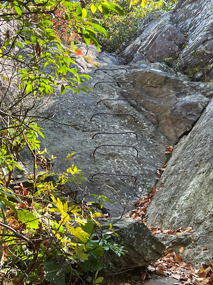
This was a pretty crazy descent, complete with rebars in the rocks.
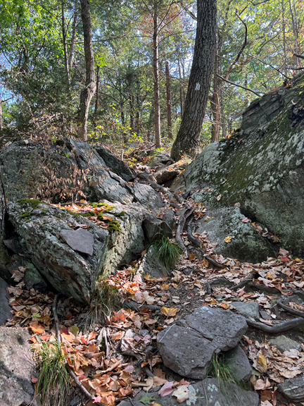
The trail alternated between being a rocky woodland path and a rock scramble. Sometimes I was walking along, and sometimes I was sitting on my butt trying to figure out how to move my body 6’ vertically downwards!
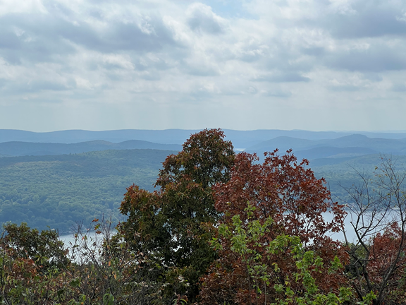
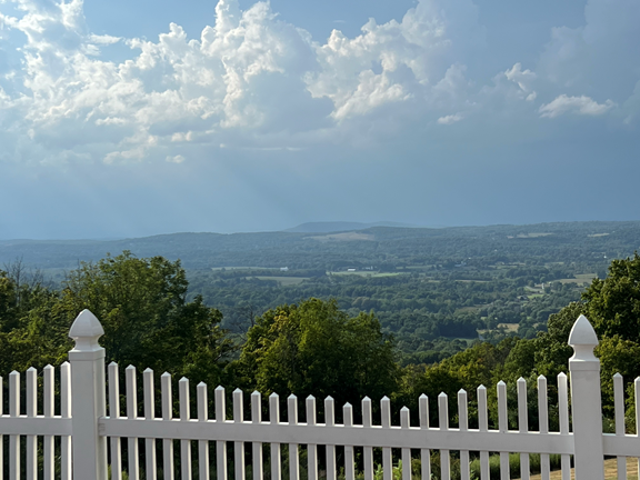
What made the trail particularly challenging was the super abundance of false white blazes and the dearth of real ones! The white marble striations in the rock frequently looked frustratingly like white blazes, and sometimes I couldn’t find a white blaze at all. I had to retrace my steps, searching for the trail at least 20 times today. I finally made it to Prospect Rock (1433’), the highest point on the AT in New York. Supposedly on a clear day you can see the New York skyline, but today the haze made that impossible. However, I still had a great view of rolling hills that seem to go on forever.
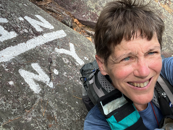
Almost immediately after Prospect Rock I arrived at the NJ/NY border.
The majority of the rock scrambles in this tough section are in New York, but the trail still had one remaining challenge. The rock pictured below consists of a 12 foot vertical drop. Before clambering down it, I triple-checked to make sure the trail actually went down that way. There was no way I was going back up it once I went down! Eventually I sat on my butt and did a lot of bracing with my hands and legs to slowly lower myself down.
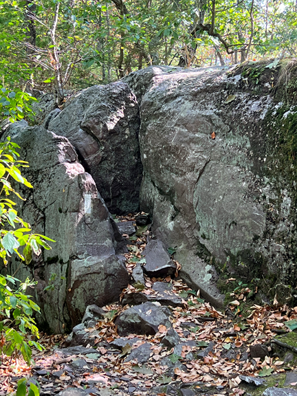
Interestingly, this rock causes northbound hikers with dogs much consternation since the dogs can’t climb up it. The usual solution is to tie a rope around the dog and hoist it up! I hate to think about the dog’s opinion of this procedure!
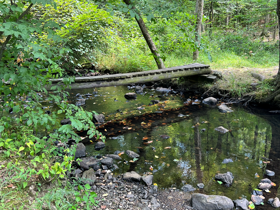
I finally came across a stream, a bona fide body of water that I could imagine drinking water from — the only one I have seen in all of New Jersey. I was so excited about it that I had to take a picture!
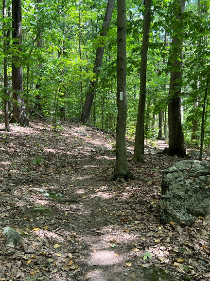
After all the rock climbing excitement, my New Jersey section ended with a pleasant stroll in the woods.
Currently in this area the trail is empty. I saw no one else during my hike today, and yesterday I saw only one other backpacker. Hostel owners say that the heat and the drought are keeping section hikers at home this summer. All I know is that the at the moment the AT is a lonely place to be.
After a quick shuttle to my B&B I had a rejuvenating shower and grabbed an eclectic dinner at one of the many boutique farmstands in the area. For dessert I headed to the Bellvale Creamery, an ice cream stand right off the AT on Rt 17A (where I began my hike today) that is renowned for its great ice cream. To celebrate my completion of the New Jersey section I had two scoops, and I can testify that the ice cream there is first rate. The view from the parking lot wasn’t bad either!
Tomorrow, instead of following my plan to complete the Connecticut section of the Appalachian Trail, I am heading home. This was a difficult decision but I have some good reasons: 1) I have a blister under one of my toenails that really hurts; 2) there are basically no hikers in this area right now so it’s quite lonely on trail; 3) the drought has made finding enough water on the trail a very dicey proposition. I have decided to save hiking Connecticut for June of 2023, when there should be more water and more hikers on trail!
I am officially done doing miles on the Appalachian Trail for 2022!
Today is a great day for a long walk in the woods!
Fantastic pix, Gwen!!
Looks like you’ve definitely mastered some rock climbing skills this leg of the AT! 🦵 👟
Congratulations on a great year of hiking the trail! Hope that blister heals up soon. Ouch!
And — You certainly “earned” those
two scoops of ice cream!! 🍦
Great pictures! I’m glad you’re taking a break. Enjoy your fall!